Sutherland Street Shared Pedestrian and Cycle Path
Revised: 19 June 2020
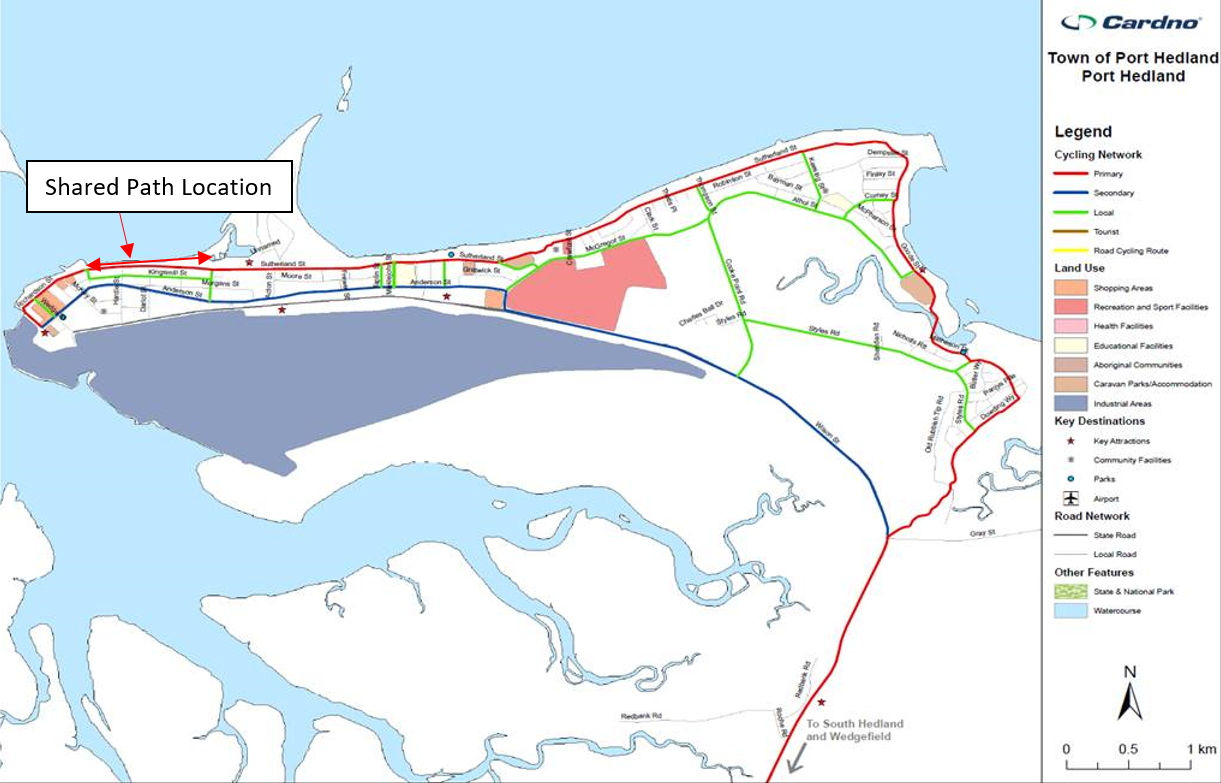
Figure 1: The primary cycling network from the Pilbara Cycling Strategy 2050
Council is constructing a shared pedestrian and cycle path along the foreshore to improve connectivity between the upcoming Marina Development and West End precinct of Port Hedland. The need for the path is due to the significant missing link in the Port Hedland Pedestrian & Cycle Network along the foreshore, which has been highlighted in a number of strategic documents including:
- Town of Port Hedland Cycle Plan (2008);
- Port Hedland Foreshore Master Plan (2013);
- Port Hedland Parks and Paths Strategy (2018); and
- Pilbara Cycling Strategy 2050 (2020) Figure 1
Whose land is it and what can it be used for?
The relevant land is road reserve under the care, control and management of the Town of Port Hedland in accordance with the Land Administration Act 1997 (the Act), and was dedicated as road reserve in 1978. Section 55(1) of the Act identifies that all land comprising a road is revested in the Crown. Further, Section 55(2) provides that the relevant local government has the care, control and maintenance. The land can be used as a road or alternative public thoroughfare. In this instance, the Town has chosen to construct only a shared path.
HOW IS THE TOWN consulting with the community and affected landowners?
Since 2008, the area has been identified in a number of strategic documents as a ‘missing link’ in the existing network of pedestrian and cycle paths, such as the Town of Port Hedland Cycle Plan (2008) and the Pilbara Cycling Strategy 2050 (2020). Extensive community consultation carried out for the Strategic Community Plan 2018-2028 uncovered a desire to improve Hedland’s existing infrastructure, particularly in regards to upgrading the amenity of Hedland’s pathway network
The Town is ensuring that any adjoining landowners will be informed of the details of the shared path. All construction will be within the road reserve managed by the Town.
WHy do works have to commence at the end of july?
The Town of Port Hedland has an ambitious 20/21 capital works program. This is a project that is identified to be completed in the first quarter by the Town of Port Hedland Infrastructure Team.
WHY IS THE SHARED PATH BEING CONSTRUCTED AT THE TOP OF THE DUNE, AND NOT AT THE BOTTOM?
There are significant environmental, cultural heritage, erosion and budget benefits to constructing the shared path at the top of the dune batter. The planned alignment also joins with the existing parts of the network which are currently in use.
WHY IS THE SHARED PATH BEING CONSTRUCTED SO CLOSE TO MY PROPERTY BOUNDARY?
The Town is planning to only build in the road reserve managed by the Town. Currently the path will be a minimum of 1m offset from the cadastral lot boundaries. The area is listed as a ‘road reserve’ however rather than a road being constructed the shared pedestrian cycle path will better serve the community’s needs.
MY PRIVATE courtyard fronts the ocean and i don't have a fence. I'm concerned about security as people will be walking close to my house
Review of historic satellite imagery data shows that the majority of properties had rear fences circa 1995. Fencing of properties remains the responsibility of the property owner. Public access was possible prior to this project.
THIS WILL IMPACT MY VIEWS / PROPERTY VALUE
The shared path will not obscure any views. The improved connectivity within the foreshore will provide a significant community benefit.
I HAVE PLANTED MY GARDEN WITHIN THE PROPOSED FOOTPATH AREA. I OBJECT TO THE COUNCIL REMOVING MY GARDEN
As previously mentioned road reserve is Crown Land, under the care, control and maintenance of the Town as a Local Road. Council has no plans to build a road but the shared path is part of a greater project focused on the foreshore. As such the road reserve is not land available for private benefit or use.
WHY CAN'T THE FOOTPATH BE REALIGNED TO RETAIN MY GARDEN AREA?
The road reserve is public land and should not be encroached by property owners.
I WILL LOSE ALL PRIVACY TO MY COURTYARD AREA, WHAT WILL THE COUNCIL DO TO COMPENSATE ME?
There is currently access from the beach to the road reserve. Privacy screening/fencing is the responsibility of the landholder and as stated above, a review of satellite imagery data shows that the majority of properties had rear fences circa 1995. The Town will not be compensating any owners for their encroachment into the road reserve.